Ha Ling Peak, Canmore: A Steep Climb Above the Bow Valley
Forest switchbacks, stairs and a loose rocky finish above Canmore, with the maintained saddle trail as a shorter destination.

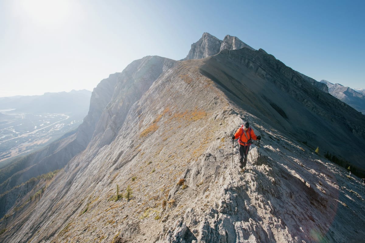
From Canmore, Ha Ling looks steep. From the trail, it remains committed to the idea. The climb starts close to town and takes you from forest to a saddle, with a rougher final stretch to the peak.
The maintained trail to the saddle is a substantial mountain walk in its own right. Continuing to the summit adds loose rock and exposure, with the same terrain to descend afterwards. Allow four to six hours with stops for the full outing.
At a glance
| Distance | About 8 km return to the summit |
|---|---|
| Elevation gain | About 810 m to the peak (Alberta Parks) |
| Time | Allow 4 to 6 hours with stops |
| Difficulty | Difficult; sustained steep climbing and loose upper terrain |
| Route | Out and back; maintained trail ends at the saddle |
| Trailhead | Across Highway 742 from Goat Creek parking |
| Facilities | Day-use parking; carry water, food and mountain layers |
| Vehicle pass | Kananaskis Conservation Pass, unless exempt |
Trail map
Explore the route and recent trail reviews.
View this trail on AllTrailsForest switchbacks and stairs
From Goat Creek parking, cross Highway 742 to the signed Ha Ling trail. The route gains height promptly through the forest, with little level ground to disguise the effort. Trees provide shelter for the lower climb, then open out as you get higher.
Stair sections help carry the maintained trail through steeper ground. Between them, the rock and uneven footing still feel like a mountain path rather than a staircase to a viewpoint. Looking back during a breather reveals how far above the valley you've come.
As the trees thin, the wind becomes more noticeable. The jacket that felt unnecessary in the car park often makes a welcome reappearance at the saddle, especially during a longer stop.
The saddle or the summit?
Alberta Parks maintains the trail for 3.5 km to the saddle. This is a useful destination for anyone wanting to remain on the built trail, with a view of the upper slope before deciding on the final climb.
The last 400 metres to the peak gains about 103 metres on loose, unmaintained ground. It's a clear change from the forest trail and stairs: footing takes more attention, and the descent can be slower than the climb.
Leave space between walkers on the loose slope to avoid sending stones onto people below, and put poles away when hands are needed for balance. The upper section suits walkers comfortable returning over that same ground; the saddle is the finish for the maintained route.
Canmore from above
At the peak, the Bow Valley spreads below and Canmore becomes a much smaller place. Roads and buildings give the height a scale that distant mountain summits alone can't provide. The view is broad without needing to stand at the cliff edge.
Wind may shorten the summit stop even after a warm climb through the trees. The return reverses the whole sequence: loose rock, saddle, stairs and forest switchbacks. Poles can be helpful on the long descent.
Ha Ling makes a good choice when the climb itself is part of the attraction. For a gentler mountain-view outing, Grassi Lakes is nearby, while the Quarry Lake loop keeps the walking much easier.
Getting to Goat Creek
Drive up Highway 742, the Smith-Dorrien/Spray Trail, from Canmore past the reservoir to Goat Creek. Allow for the winding road and gravel sections. The parking area has day-use facilities, and vehicles need a Kananaskis Conservation Pass unless exempt; a Banff National Park pass doesn't cover it.
This guide describes dry, snow-free conditions. Snow and ice introduce avalanche and fall hazards beyond the ordinary summer hike. Carry food, water, grippy footwear, warm and waterproof layers, bear spray, a headtorch and an offline map. Dogs must be leashed where permitted, though the loose summit slope makes them awkward companions for the upper section.
Ha Ling gives you a mountain day without a long drive from Canmore. By the time you're back at Goat Creek, a meal in town is likely to look more attractive than another climb.
FAQs
How long does Ha Ling Peak take?
Allow roughly 4 to 6 hours with stops, depending on pace and whether you continue from the saddle to the peak.
Is the whole route maintained?
No. Alberta Parks maintains the 3.5 km trail to the saddle. The final 400 metres to the peak crosses unmaintained, loose rocky ground.
Can you stop at the saddle?
Yes. The saddle is a useful destination if you want to stay on the maintained trail or the summit section doesn't suit the group.
Which parking pass do you need?
Vehicles parked at Goat Creek need a Kananaskis Conservation Pass unless exempt. A Banff National Park pass doesn't replace it.