Grassi Lakes Trail, Canmore: Two Ways to the Turquoise Lakes
The easy forest route and steeper waterfall trail reach the same Grassi Lakes. Compare distances, winter restrictions, parking and which route suits your group.

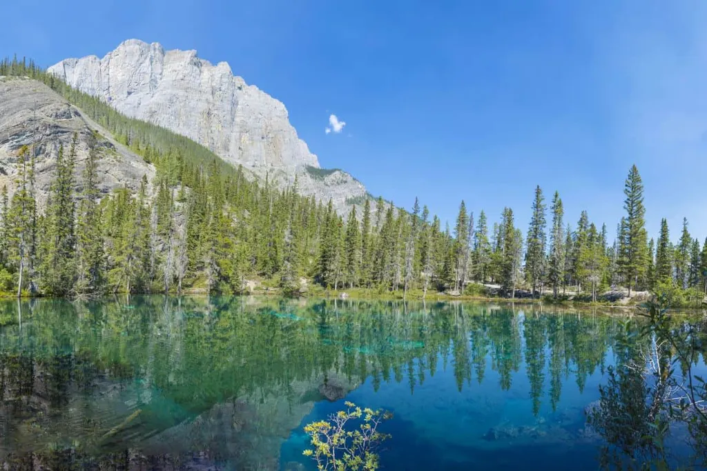
Grassi Lakes is one of the first hikes people ask about when they arrive in Canmore, and it's easy to see why. Two small turquoise lakes sit beneath a pale limestone cliff, yet the trailhead is only a short drive from town. The surprise is that two quite different walks reach them. One is a steady forest climb; the other adds a waterfall, steep steps and a wider view of the valley.
I've hiked Grassi Lakes more times than I can count, in every season, and it doesn't feel quite the same twice. Spring brings the waterfall to life; winter turns the lakes and path into a different landscape altogether. What hasn't changed is my preference in good summer conditions: take the steeper Interpretive Trail up, enjoy the view, then come down the easier forest route. It's a satisfying little loop without having to negotiate those steps downhill.
Quick facts
| Distance | About 4 km return |
|---|---|
| Time | Allow 1.5-2 hours including time at the lakes |
| Elevation | About 125 m on the Interpretive Trail |
| Difficulty | Easy Upper trail; moderate Interpretive trail |
| Route | Out and back on Upper, or summer loop using both |
| Trailhead | Grassi Lakes parking off Ken Ritchie Way |
| Dogs | On leash; stay on designated trails |
| Facilities | Parking and toilets at trailhead; not at lakes |
Grassi Lakes Interpretive Loop map
Planning this walk?
View the mapped route and recent reports on AllTrails.
View this trail on AllTrailsThis map shows the summer loop: up the steeper Interpretive Trail and back down the easier Upper Trail. In winter, the Interpretive Trail closes, so use the Upper Trail both ways.
Which Grassi Lakes trail should you take?
The decision arrives almost immediately. A signed fork around 100 metres from the trailhead sends the Upper Trail right and the Interpretive Trail left. The Upper is a broad old roadway under the trees, with a steady climb that lets you settle into a rhythm. If somebody in your group wants the lakes without a steep, rocky section, this is the route I'd point them towards.
The Interpretive Trail is the more interesting way up when it's open and conditions are good. The path follows the canyon, the sound of the waterfall grows as you climb, and the Bow Valley suddenly opens beneath you. Steps and rocky patches make this branch more demanding, and unsuitable for pushchairs or anyone uncomfortable on steep ground.
The two branches meet at the lakes, so you can see both landscapes without walking the same way twice. Going up the steeper side and down the broad Upper Trail is a sensible choice for confident walkers in summer.
Alberta Parks describes both branches of Grassi Lakes and identifies the winter closure of the Interpretive route. On-site notices cover any temporary restrictions.
Reaching the lakes
The wider Upper Trail still climbs steadily to the lakes. It suits families who are comfortable with an uphill walk but prefer to avoid the Interpretive Trail's rocky steps.
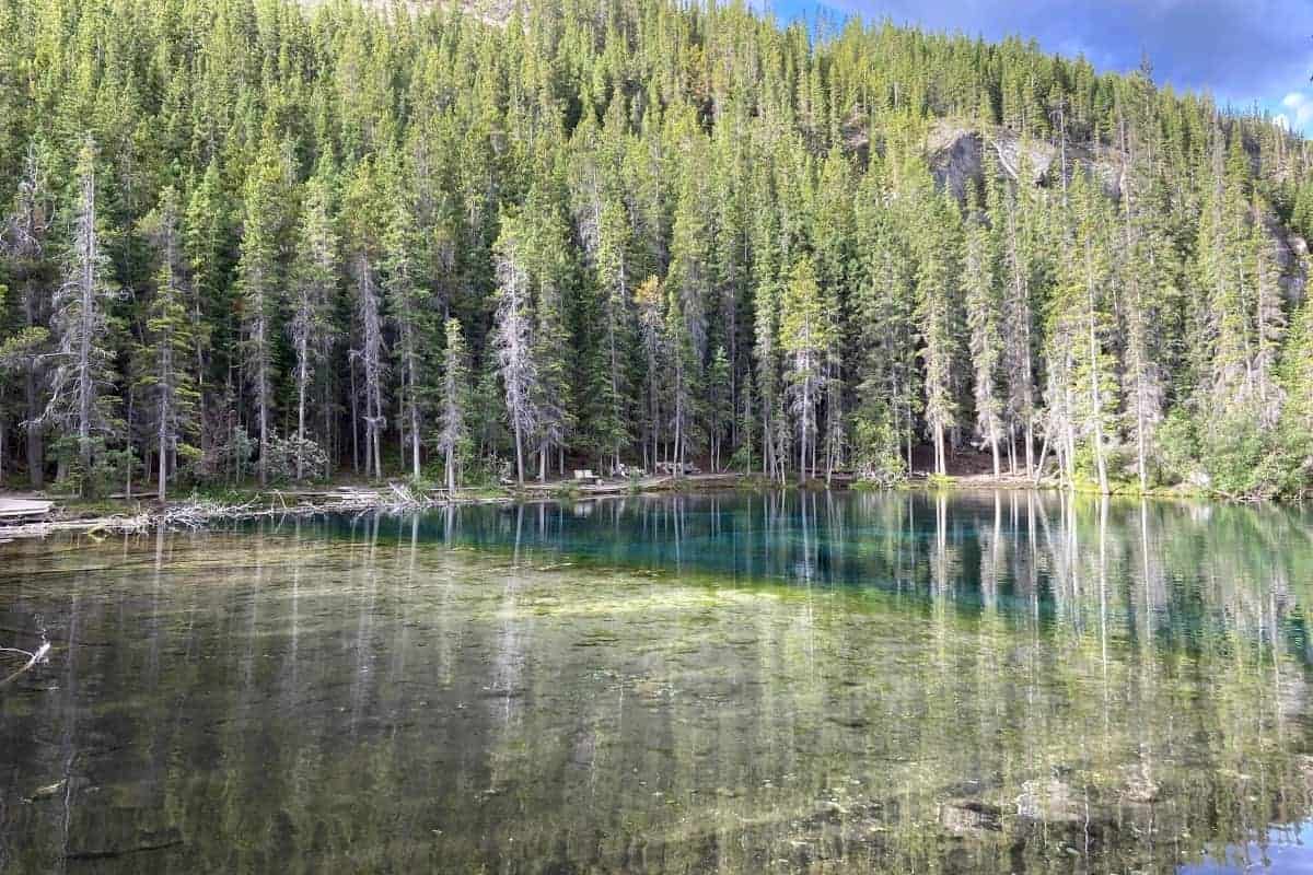
The lakes are smaller than some first-time visitors expect, which makes their colour even more striking. Clear water lies against pale stones, pine trees and the cliff, with enough variation in the light to keep photographers moving a few steps and trying again. You don't need a long circuit of the shore to appreciate them.
There are places to pause by the water, although a sunny weekend can mean sharing them with half of Canmore. Bring a snack and enjoy the setting, but keep food secured and give other walkers room on the narrow sections.
The cliffs above the lakes are used by rock climbers. Falling rock is a hazard beneath active climbing routes, so choose a resting spot away from the climbers overhead and keep to the designated walking paths.
Lawrence Grassi wasn't just a name picked for a map. The Italian-born mountaineer and trail builder helped shape routes around Canmore, and the lakes keep that connection alive. It's a nice piece of local history to think about as you climb a trail that so many people now use as their introduction to hiking here.
Getting to Grassi Lakes and parking
From town, follow Spray Lakes Road towards the Nordic Centre and the signed turn for the Grassi Lakes parking area on Ken Ritchie Way. The parking area gets busy on summer weekends. An early arrival helps; the access road needs to remain clear when the car park is full.
If you park a vehicle at the Grassi Lakes trailhead in Kananaskis Country, you need a Kananaskis Conservation Pass unless an exemption applies. People arriving without parking a vehicle do not need this pass. Check Alberta's current pass information before driving.
Roam Route 12 serves Grassi Lakes in summer. Check Roam Route 12's current stops and timetable for current stops; the service to the trailhead doesn't continue through autumn and winter.
Conditions and what to bring
Gravel on the Upper Trail can be loose or icy. In spring, wet patches and lingering snow can surprise people who have just left dry streets in Canmore. Sturdy shoes help on the loose gravel.
When the Interpretive Trail is closed, the winter route follows the Upper Trail both ways. Ice cleats may be needed, and recent snow can conceal uneven ground.
Carry water, an extra layer and bear spray, and know how to use it. Dogs must be leashed. The designated paths keep walkers within the permitted route through this wildlife corridor.
Allow time for the viewpoints, not just the distance. The nicest part of the hike is reaching the lakes and having a few minutes to sit beside the clear water. It gets busy, yes, but it is popular for a reason.
Another short stop in Canmore
If you're looking for an easier outing after Grassi Lakes, the Canmore family walks guide includes several flatter alternatives closer to town, including Quarry Lake and the Bow River.
Grassi Lakes earns its place on a Canmore itinerary through variety rather than distance. You get a forest climb, perhaps a waterfall, and those two clear lakes tucked under the cliff. The lakes give either route a satisfying finish.
FAQs
How long is the Grassi Lakes hike?
Allow around 1.5-2 hours for the roughly 4 km outing, including time to enjoy the lakes.
What's the difference between the two Grassi Lakes trails?
The Upper Trail is a wider, easier former road. The Interpretive Trail is steeper, with rocky sections, steps and a waterfall viewpoint.
Can you hike Grassi Lakes in winter?
The easier Upper Trail can be used when conditions permit, but the Interpretive Trail closes in winter because of ice. Check current Alberta Parks notices.
Is Grassi Lakes suitable for children?
Many families use the Upper Trail. It is still an uphill outdoor trail, so choose footwear and pace accordingly; the Interpretive route is more demanding.
Are dogs allowed on Grassi Lakes Trail?
Dogs are allowed on leash. Stay on designated trails in the wildlife corridor.