
Parker Ridge: A Short Climb to Saskatchewan Glacier Views
Climb Parker Ridge for the view down the Saskatchewan Glacier valley: a 5.4 km return walk near the Columbia Icefield.

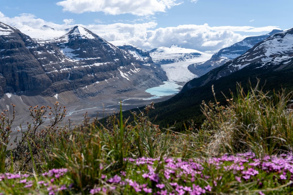
Parker Ridge keeps the Saskatchewan Glacier hidden until you've done the climbing. From the car park, you see the slope ahead; over the crest, the scene opens into a long glacier valley. It's quite a change for a walk that takes only a few hours.
The standard route is 5.4 km return, with a sustained ascent rather than a long approach. It makes an excellent main walk on an Icefields Parkway driving day, especially when you want more than another photograph taken beside the car.
At a glance
| Distance | Standard park route: 5.4 km return; linked AllTrails track about 6.9 km |
|---|---|
| Elevation gain | Banff park guide: 305 m gain and 45 m loss outward |
| Time | Allow about 3 hours for the standard walk; longer for the full mapped track |
| Difficulty | Moderate; steady switchbacks and an exposed ridge |
| Route | Out and back to glacier viewpoints |
| Trailhead | Parker Ridge parking area on Highway 93N |
| Facilities | Roadside trailhead; carry all food and water |
| Season | July to mid-September, once the ridge is snow-free |
Trail map
Explore the route and recent trail reviews.
View this trail on AllTrailsUp the switchbacks
The trail leaves the signed parking area on Highway 93N and climbs through low trees towards the open ridge. Switchbacks spread the ascent across the slope, with the highway and the country around Nigel Pass appearing behind you as you gain height.
You can see much of the climb from below, which makes the route easy to picture. It also removes any hope that the uphill section might be somewhere else. The gradient is steady, and the established bends provide a manageable line through the fragile alpine vegetation.
Near the crest, the shelter disappears. The ridge can be breezy even on a pleasant day, so a jacket is useful for the stop after the climb. This is a short mountain hike, with rough ground and an exposed upper section, rather than a level viewpoint stroll.
The Saskatchewan Glacier view
Continue over the crest on the established path to the glacier viewpoints. The ice lies below between bare mountain slopes, with the valley stretching away beyond it. From this height you see the glacier as part of the landscape, rather than just its front edge.
That wider perspective is Parker's great appeal. The walk is compact, but the outlook isn't: the ice, rock and valley occupy far more of the scene than the little climb from the road suggests.
Clear weather makes a real difference. Some cloud can add contrast to the mountains, but a ridge enclosed in cloud loses much of the view you've climbed for. The route stays above the glacier valley; it does not descend to the ice or include glacier travel.
Return along the same trail and switchbacks. With around three hours available for the standard walk and a viewpoint stop, there is time for lunch on the ridge without turning the rest of the drive into a race.
Distance and the map
The Banff hiking listing gives 2.7 km each way, with 305 metres of gain and 45 metres of loss outward. The linked AllTrails track is approximately 6.9 km return, so its distance should not be substituted for the park's standard 5.4 km walk.
Fitting Parker into the Parkway
The car park is about 40 km north of Saskatchewan River Crossing and 9 km south of the Icefield Centre, in Banff National Park close to the Jasper boundary. Bow Lake offers a gentler shoreline stop on the journey from Lake Louise.
July to mid-September is the main hiking season. Snow-covered slopes involve avalanche terrain; the summer description is not a winter walking plan. Grippy shoes and warm, waterproof layers suit the exposed ridge, alongside food, water and normal day-hike equipment; dogs must be leashed, subject to wildlife restrictions.
National park entry is required, and the official Parkway travel information covers the drive's limited services and reception. Arrive with supplies and a saved map rather than relying on a connection at the trailhead.
A few hours at Parker Ridge can become the part of the Parkway day you remember most clearly. The car gets you close to the mountains; this small detour on foot gives you a very different view of them.
FAQs
How long is the Parker Ridge hike?
The standard Parks Canada route is 5.4 km return. The AllTrails track is longer, at about 6.9 km.
How much time should you allow?
Allow about three hours for the standard walk, including a viewpoint stop. Following the longer mapped track takes additional time.
Do you walk on the glacier?
No. Parker Ridge gives you a view towards the Saskatchewan Glacier from above. It doesn't include walking on glacier ice.
Is Parker Ridge suitable for children?
It can suit children accustomed to sustained uphill walking and uneven trails, with close supervision on exposed ground. It isn't suitable for strollers.


