
Aylmer Lookout Trail, Banff: A Full Day Above Lake Minnewanka
A full-day walk from Lake Minnewanka to an old fire-lookout site, with clear guidance on the summer group restrictions and long return.

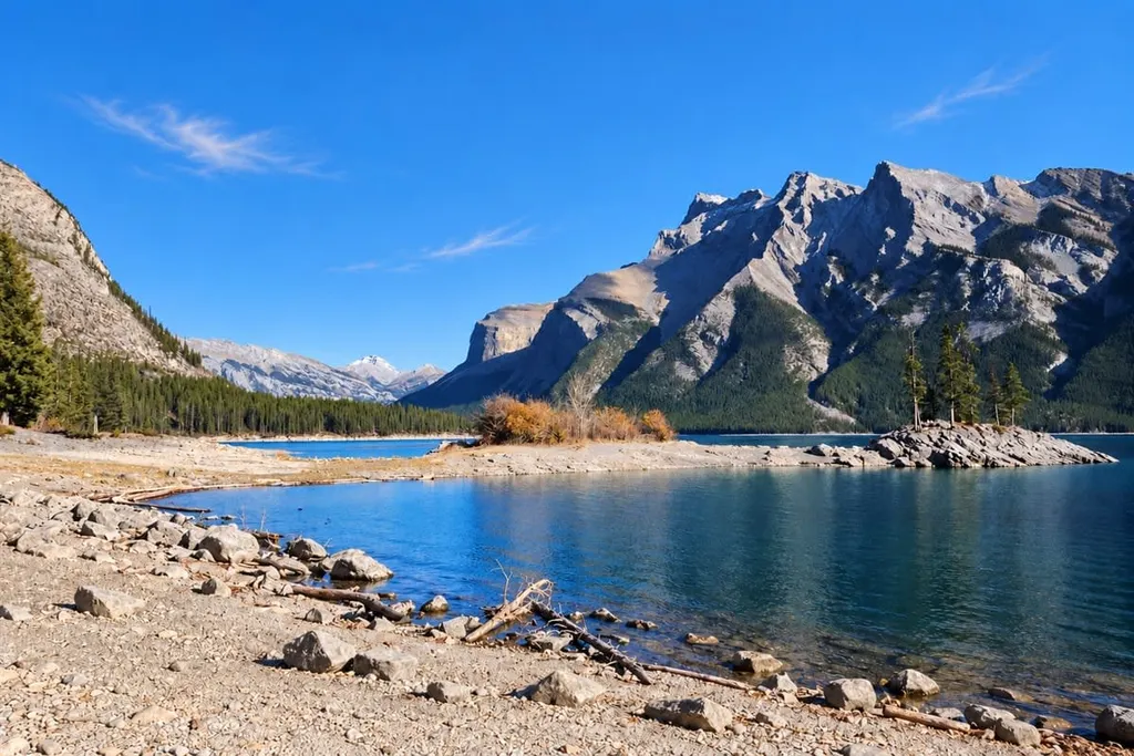
Aylmer Lookout is a long day that starts beside Lake Minnewanka and finishes high above it. The shoreline approach gives way to a sustained climb, with the former fire-lookout site offering a wider understanding of the reservoir’s shape and the mountains around it.
Allow a full day for the more-than-twenty-kilometre return walk. The rolling shoreline approach is a substantial part of the hike in both directions, and seasonal wildlife restrictions affect access.
At a glance
| Distance | About 23.3 km return on the linked AllTrails route |
|---|---|
| Elevation gain | About 869 m cumulative gain on that mapped route |
| Time | Allow 7–9 hours, with extra margin for your pace |
| Difficulty | Difficult: long distance and sustained climbing |
| Route | Out and back to Aylmer Lookout, not Aylmer Pass |
| Trailhead | Lake Minnewanka Day-use Area |
| Seasonal restrictions | July 10–September 15: groups of at least four, bear spray required; no dogs beyond Stewart Canyon Bridge |
| Facilities | Parking and toilets at the main day-use area; carry supplies |
Parks Canada lists 11.6 km each way and 7–8 hours return. Its elevation figures describe the outward journey, while the linked AllTrails figures cover the full return track.
Trail map
Explore the route and recent trail reviews.
View this trail on AllTrailsThe shoreline is only the approach
Start at the Lake Minnewanka day-use area and follow the lakeshore signs towards Stewart Canyon.
Stewart Canyon Bridge marks the start of the area covered by the recurring summer group and dog restrictions described below.
The approach rolls through forest above the lake, with small climbs and descents before the sustained ascent at the Aylmer junction.
Views across the water alternate with enclosed forest. Travel together and make your presence known around bends.
At the signed Aylmer junction, take the uphill route. The main lakeshore trail continues much farther along Lake Minnewanka.
The climb to the old lookout
Beyond the shoreline, the path climbs steadily through roots, rocks and narrow sections. The change in gradient gives this part of the day a different feel.
The lookout and Aylmer Pass share part of their approach before separating. Follow the signs for Aylmer Lookout; the pass is a different destination.
The destination is a decommissioned fire-lookout site. Like other lookout locations, it was chosen for the view across the surrounding country. Today the main reason to make the climb is the sweep of Lake Minnewanka beneath the mountains.
The open lookout can be windy and cool, so a warm layer is useful for the stop. Keep to established ground, clear of steep edges.
Return by the same route. Descending to the shoreline junction still leaves the full lakeside approach to walk back to the day-use area.
The summer rules are part of the route
From July 10 to September 15, Parks Canada requires hiking parties in this area to contain at least four people. The group must stay close together, with no more than three metres between individuals, and carry bear spray.
Dogs are prohibited beyond Stewart Canyon Bridge during that restriction period, even on leash. Cycling is also restricted there. Read Parks Canada’s Lake Minnewanka seasonal rules before organising the group.
Additional closures or warnings can apply outside those dates. Read the current trail report and trailhead notices before departure, and do not enter a closed area.
Keep bear spray accessible and know how to use it. Give wildlife space throughout the route.
Transport, timing and what to carry
From Banff, follow Lake Minnewanka Road to the main day-use area. From Canmore, reach the Minnewanka junction on the Trans-Canada, then follow signs for Lake Minnewanka.
Parking can fill on busy days. Seasonal Roam Route 6 serves Lake Minnewanka, but its first and last departures need to accommodate a seven-to-nine-hour hike, stops and any delays.
Our Roam Transit guide explains the connections from Banff and Canmore.
Use the toilets before leaving the day-use area. Bring enough drinking water, substantial food and snacks for a full day, plus waterproofs, warm layers, sun protection and a headtorch. Carry navigation you can use without relying on reception.
National park admission applies. Backcountry camping along the approach has separate permit and reservation requirements.
Leave your route and expected return with someone. A turnaround time helps keep the long return within the available daylight.
Choose a full-day hiking window
Summer into early autumn is the usual hiking season. The upper trail can retain snow, so current conditions, the forecast and available daylight matter alongside the calendar.
This is a summer hiking itinerary. Snow, ice and mountain hazards require a separate assessment for winter travel.
Aylmer suits fit, experienced walkers comfortable with long days. Families need experience of similar distances; the roots, narrow ground and sustained climb rule out conventional strollers and wheelchairs.
If the full route is too much, the broader Lake Minnewanka guide offers other ways to enjoy the area. Check restrictions even for shorter walks beyond Stewart Canyon.
The lookout gives Lake Minnewanka a new shape: a long sweep of water below the surrounding mountains. The shoreline approach is part of that experience, taking you along the lake before you see it from above.
FAQs:
How long is the Aylmer Lookout hike?
The linked route is about 23.3 km return. Allow 7–9 hours or more according to pace, stops and conditions; it’s a full-day hike.
Do I need a group of four?
From July 10 to September 15, parties beyond Stewart Canyon Bridge must have at least four people, stay within three metres of one another and carry bear spray. Other restrictions can also apply.
Can I bring my dog?
Dogs are prohibited beyond Stewart Canyon Bridge during the July 10–September 15 restriction period. Outside that period, check current notices and leash requirements before planning.
Is Aylmer Lookout the same as Aylmer Pass?
No. They share part of the approach and then separate. Follow the lookout signs and use distances for that destination.


